
About All Tours Whale Watching ToursKayak ToursFrom Juneau ToursHike ToursCanoe Tours Directions Hours & Fees Guides
Find Tours 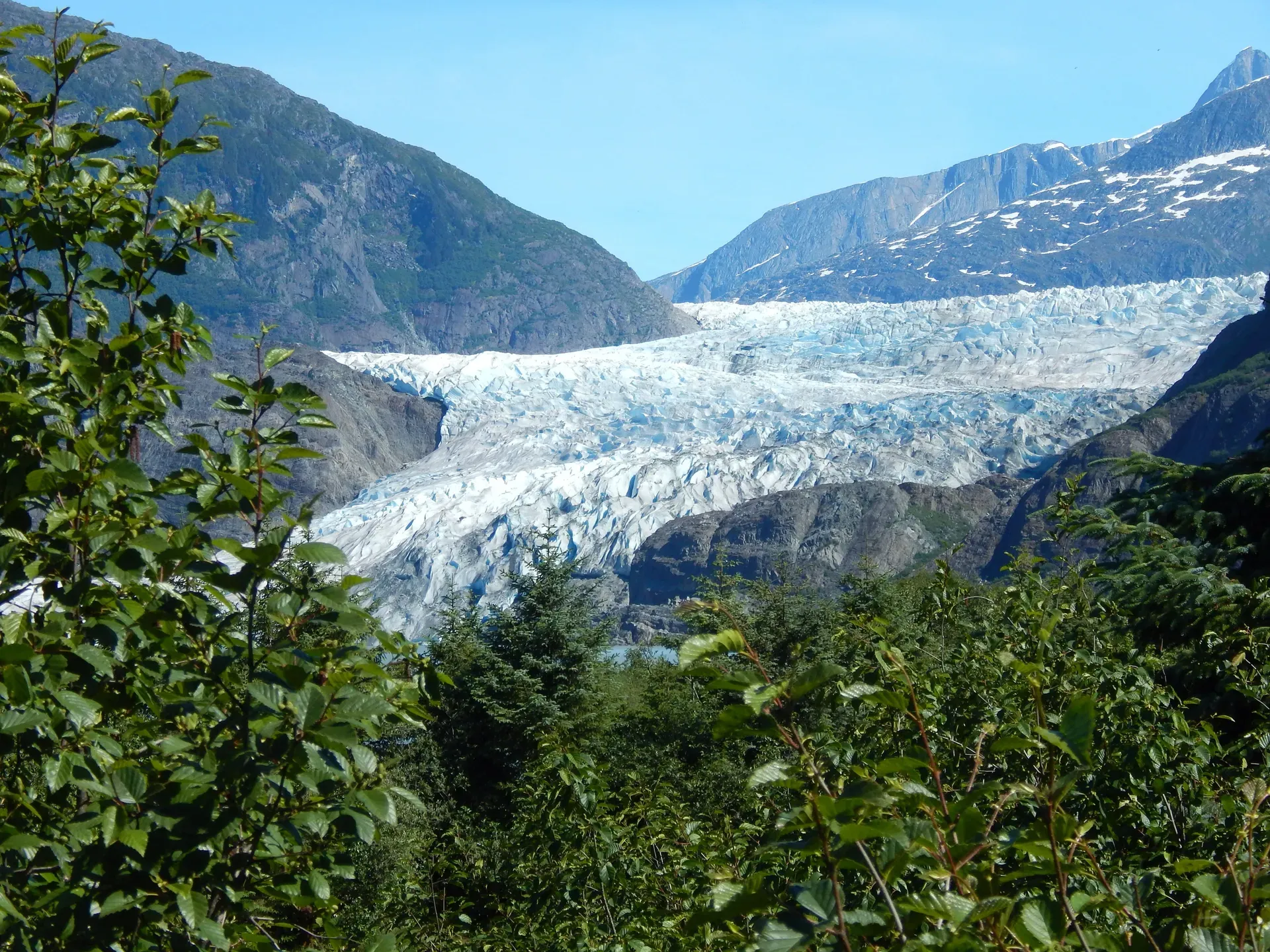
Mendenhall Glacier is a 13.6-mile river of ice flowing from the Juneau Icefield down to a freshwater lake just 12 miles from downtown Juneau. It is the only glacier in Southeast Alaska accessible by a paved road.
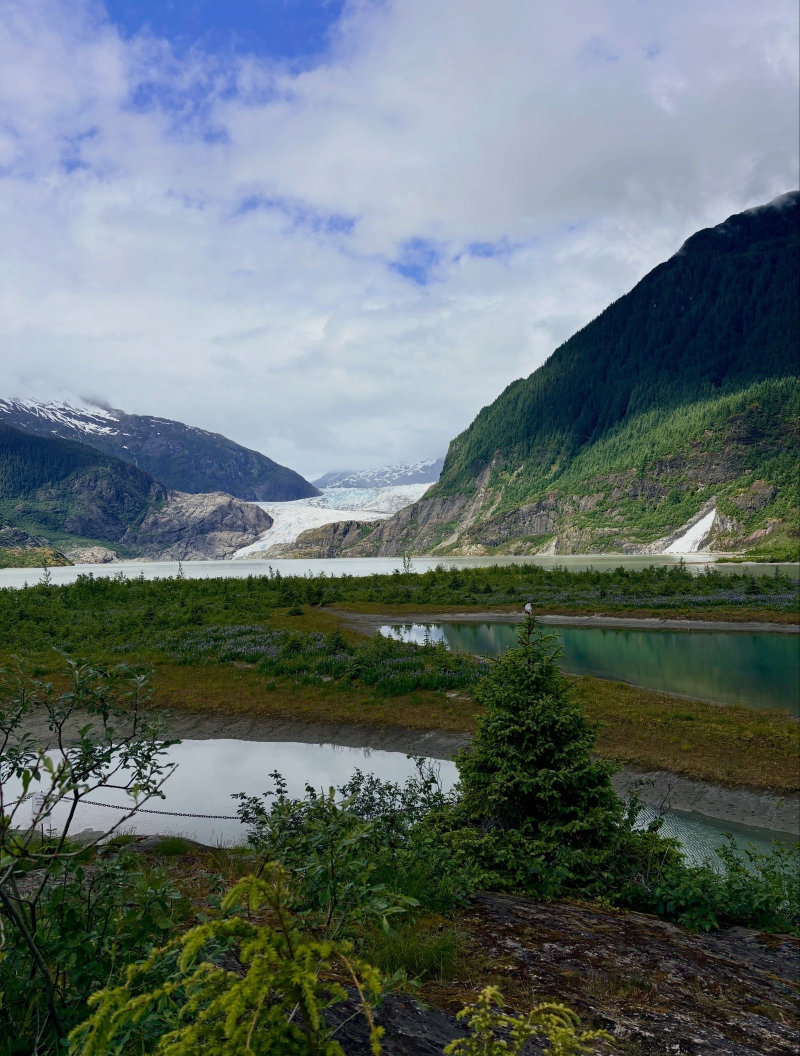
Mendenhall Glacier is a 13.6-mile-long mass of ice descending from the 1,500-square-mile Juneau Icefield. It drops 4,500 feet through the Coast Mountains before terminating in Mendenhall Lake. The site is 12 miles from downtown Juneau. It is the only glacier in Southeast Alaska you can reach by a paved road.
Roughly 700,000 people visit the 5,815-acre recreation area each year. The U.S. Forest Service manages the site and operates an interpretive center built into the bedrock above the lake. From the viewing decks, visitors feel the distinct temperature drop caused by katabatic winds rolling off the ice. The landscape includes temperate rainforest, glacial moraine, and Steep Creek. Black bears fish for sockeye salmon in this shallow stream from August into September. The America the Beautiful Interagency Passes grant free admission for the pass-holder and three guests. Otherwise, a $15 season pass covers you and a guest for the summer.
The glacier is retreating rapidly. The Juneau Icefield Research Program has monitored the ice continuously since 1942. The terminus has pulled back 1.75 miles since the lake formed in 1929. In November 2025, the glacier's face officially separated from the water for the first time in modern history.
Glacial lake outburst floods from nearby Suicide Basin frequently disrupt access. River levels hit a record 16.65 feet in August 2025. The water forces emergency closures. The floods wash out trails and destroy infrastructure in a matter of hours. The Forest Service and the City and Borough of Juneau issue immediate evacuation orders when the basin releases. Check the Tongass National Forest alerts page the morning of your visit.
Capital Transit buses do not stop at the visitor center. Riders must disembark 1.5 miles away and walk 30 minutes to reach the site. Private shuttle companies like M&M Tours run direct buses from the cruise ship docks for about $45 round trip. The ride takes 25 minutes. Once there, the paved Photo Point Trail offers a flat, wheelchair-accessible route to the water's edge. The East Glacier Loop climbs into the forest for elevated views of the icefield. Skip the public bus if you have limited mobility.
The Tlingit people call the ice Sitaantaagu, which translates to "the Glacier Behind the Town," and Aak'wtaaksit. Naturalist John Muir arrived in 1879 and named it Auke Glacier after the local Aak'w Kwaan people. The U.S. government renamed it in 1891 to honor physicist and meteorologist Thomas Corwin Mendenhall. During the late 19th century, miners and prospectors largely ignored the glacier itself. They focused instead on the gold deposits in the surrounding Gastineau Channel. The ice was simply an obstacle.
The glacier reached its maximum Little Ice Age extent in the mid-1700s. It has retreated 2.5 miles since then. As the ice pulled back across the valley floor, meltwater pooled in the depression it left behind. Mendenhall Lake officially formed in 1929. By that time, early tourists were already hiring local drivers to bring them up the dirt roads to view the terminus. The retreating ice exposed barren rock, which gradually underwent primary succession. Moss and lichens gave way to the dense Sitka spruce and western hemlock forest that covers the valley today.
The U.S. Forest Service recognized the site's accessibility early on. In 1962, the agency opened the Mendenhall Glacier Visitor Center. It was the first dedicated visitor facility in the entire National Forest System. The original structure was designed to handle just 23,000 people a year. Between 1997 and 1999, the Forest Service renovated and expanded the building. They added a theater with a rotating film about the icefield, floor-to-ceiling viewing windows, and a bookstore run by Discovery Southeast. The Forest Service eventually exempted several areas from the fee structure. The Nugget Falls Trail, Powerline Trail, and the main parking lot remain free to access.
Recent years have brought severe environmental and operational shifts. The ice face officially separated from Mendenhall Lake in November 2025. This marked a major physical transition for the valley. Federal budget cuts in early 2025 left the facility with minimal staff—news reports noted just two employees managing crowds of up to 25,000 cruise passengers a day. The agency is currently debating a plan to raise the formal visitor capacity limit to 999,000 per year. Buy your $5 day-use pass at the automated vending machines in the parking lot to skip the indoor lines.
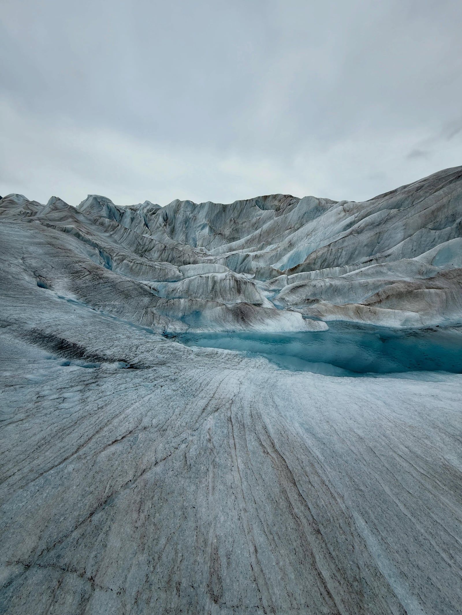
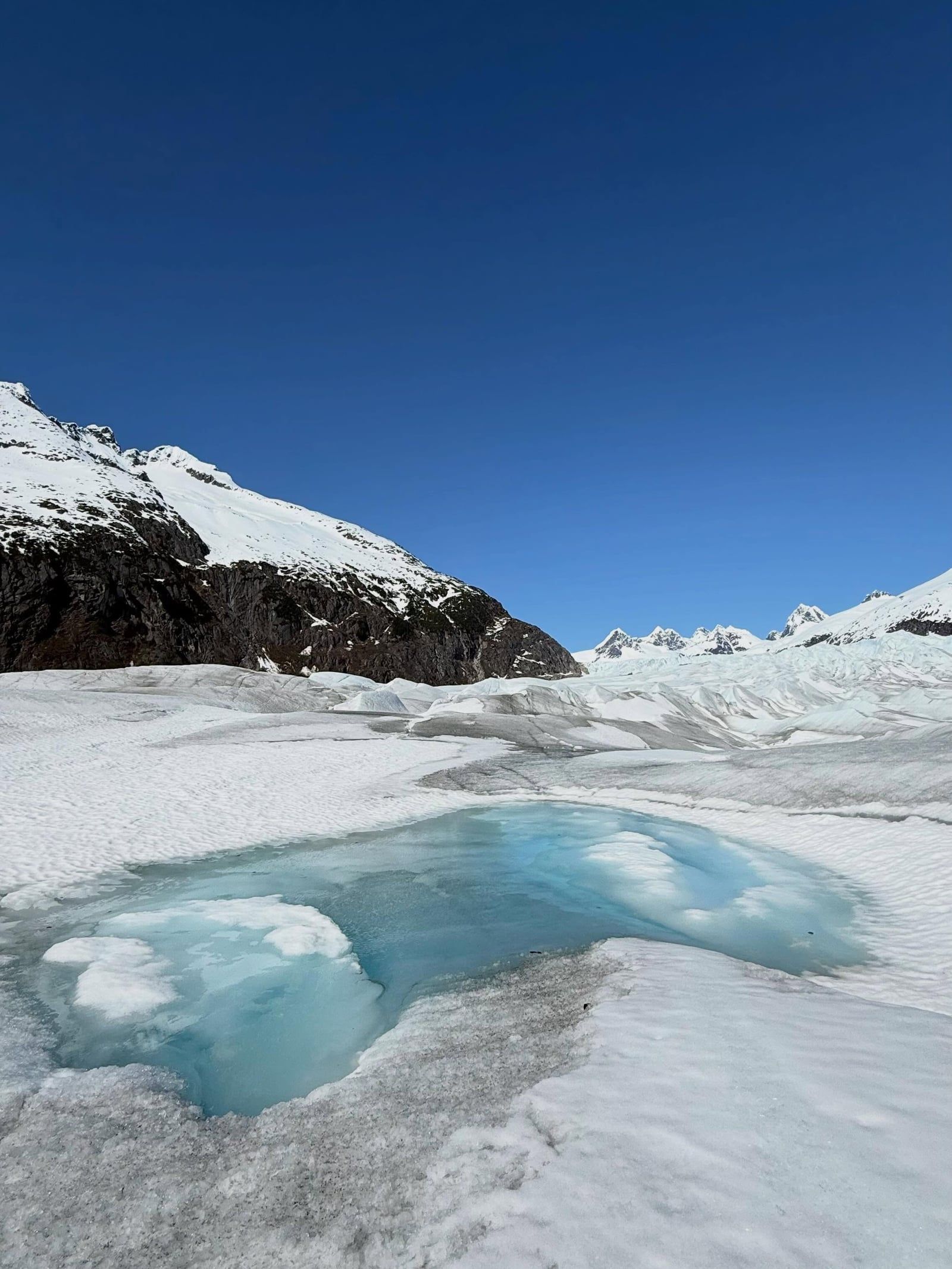
The glacier's terminus spans 1.5 miles across and rises over 100 feet above the bedrock. Radar measurements indicate the ice reaches depths of 1,800 feet in the upper sections. The ice absorbs all colors of the visible light spectrum except blue. This gives the deep crevasses and freshly calved icebergs a heavy, saturated azure tint.
Nugget Falls crashes 377 feet down the mountainside directly next to the glacier. The waterfall is fed by a separate hanging glacier and empties into Mendenhall Lake. A flat, two-mile round-trip gravel and boardwalk trail leads to the base of the falls. This path provides the closest ground-level approach to the ice face available to pedestrians. The trail gets muddy after heavy rain.
Meltwater periodically carves ice caves into the leading edge of the glacier. These subglacial channels glow bright blue when sunlight filters through the thinning ice roof. The caves are structurally unstable. The Forest Service does not maintain trails to them and actively discourages entry. Collapses occur without warning. Crossing the frozen lake in winter to reach them has resulted in serious injuries. The City of Juneau issues specific warnings against walking on the lake ice.
Steep Creek flows through the moraine near the visitor center. Elevated boardwalks cross the stream, allowing visitors to look directly down into the clear water. Sockeye and coho salmon spawn here from mid-July into October. The fish die after spawning. This provides a massive calorie source for local wildlife. Sitka spruce and western hemlock dominate the older sections of the moraine, while alder and cottonwood cling to the recently exposed gravel near the lake.
The surrounding 5,815-acre recreation area contains a network of trails through the temperate rainforest. The Dredge Lakes area features beaver ponds and quiet wooded paths. The West Glacier Trail climbs the steep, unpaved hillside on the opposite side of the lake. It offers a rugged hike for those wanting to escape the cruise ship crowds. Helicopter and floatplane tours depart from Juneau International Airport to fly directly over the ice. These flights reveal the massive crevasse fields and rocky nunataks of the 1,500-square-mile Juneau Icefield. Families should walk the Steep Creek boardwalks (keep kids away from the railings) in the early morning for the best chance of seeing black bears feeding on the fish.
Mendenhall Glacier holds deep historical ties to the Aak'w Kwaan, the indigenous Tlingit people of the Juneau area. The glacier and its surrounding valley provided a vital travel corridor and hunting ground long before European contact. The Tlingit names Sitaantaagu and Aak'wtaaksit anchor the ice to the specific geography and the people who navigated it. The Alaska State Museum in downtown Juneau displays artifacts and oral histories. These exhibits detail how the local clans adapted to the advancing and retreating ice over centuries.
Today, the glacier is a global classroom for climate science. The Juneau Icefield Research Program has brought students and scientists to the ice every summer since 1942. This continuous 80-year dataset makes Mendenhall one of the most thoroughly documented retreating glaciers on Earth. The visual evidence of its shrinking terminus forces visitors to confront environmental change directly. Physical markers along the trails show exactly where the ice stood in 1910, 1950, and 1990.
The site dictates local summer rhythms in Juneau. The arrival of the first cruise ships in May triggers a massive logistical operation. Dozens of shuttle buses run the 12-mile route from the docks to the visitor center. The glacier drives the city's tourism economy. Local taxi companies, kayak outfitters, and flightseeing operators rely entirely on the five-month summer window. During the winter months, locals use the frozen edges of the recreation area for cross-country skiing and snowshoeing. The visitor center drops its hours to just Fridays and Saturdays from November through March.
The glacier also shapes local policy and infrastructure. The persistent threat of glacial lake outburst floods from Suicide Basin forces the city to maintain emergency response plans. When the basin drains, the resulting floodwaters inundate nearby roads and neighborhoods. The community lives in direct tension with the ice above it. Commercial access to the water is strictly capped. Only a few permitted outfitters can lead kayak or canoe tours on Mendenhall Lake. These small groups paddle among the floating icebergs to view the calving face. Independent travelers should rent a car and arrive before 9:00 a.m. to experience the valley before the first tour buses pull in.
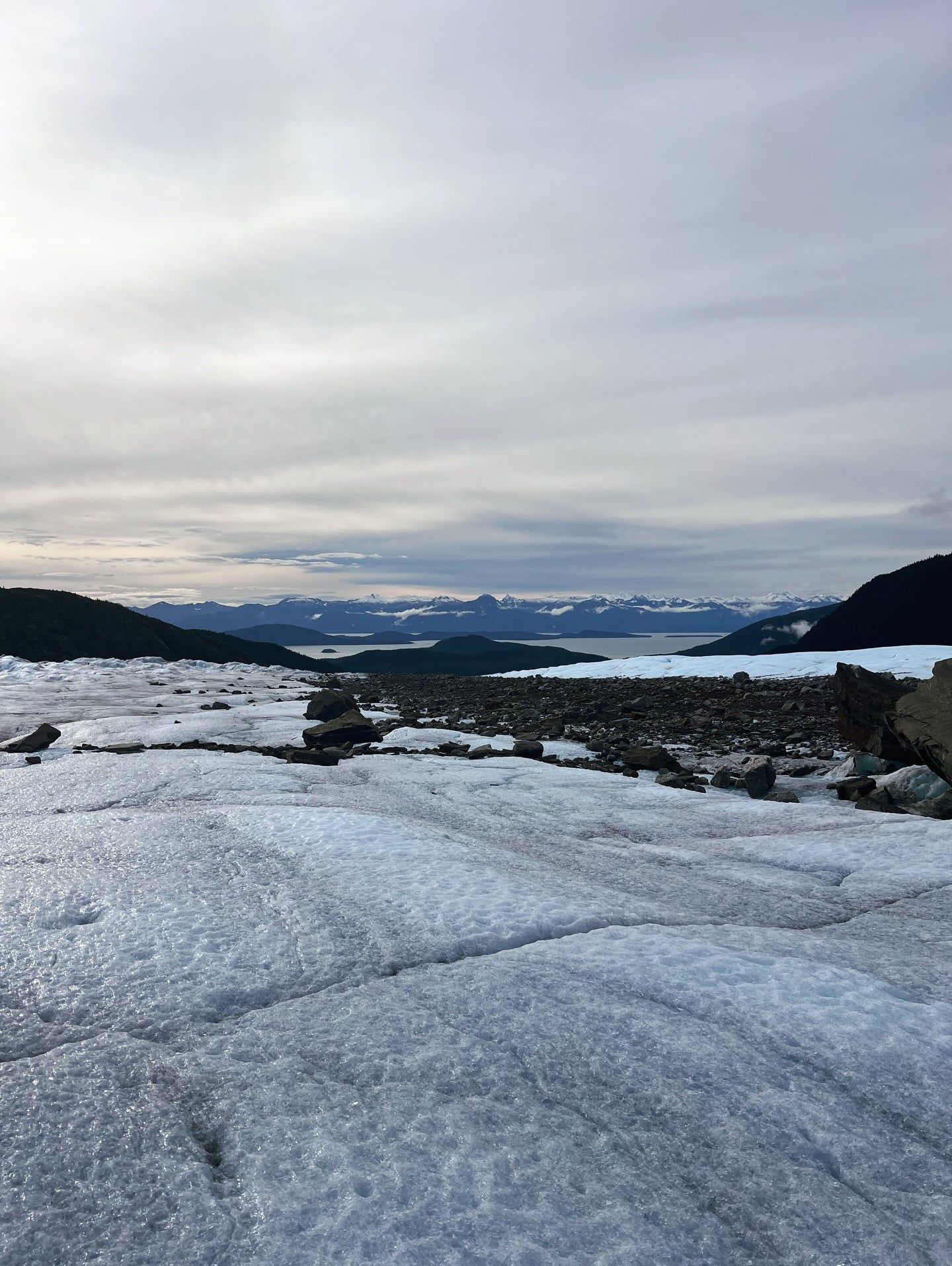
The glacier absorbs all colors of the visible light spectrum except blue, giving the ice a heavy azure tint.
Black bears regularly fish for sockeye salmon in Steep Creek just yards from the visitor boardwalks.
Glacial lake outburst floods from Suicide Basin raised the local river to a record 16.65 feet in August 2025.
The Juneau Icefield feeding the glacier covers 1,500 square miles of the Coast Mountains.
The Mendenhall facility was the very first visitor center built in the U.S. National Forest System.
The ice face officially separated from the waters of Mendenhall Lake in November 2025.
Only a handful of outfitters hold permits to lead kayak tours among the lake's floating icebergs.
The visitor center charges a $5 per person day-use fee from May through September. Visitors 15 and under enter for free. The Nugget Falls Trail and parking areas do not require a pass.
You cannot walk directly onto the ice from the visitor center. The closest pedestrian approach is the end of the Nugget Falls Trail across the lake. Getting onto the ice requires booking a helicopter flightseeing tour or a guided kayak trip.
The visitor center is 12 miles from downtown Juneau and 5 miles from the airport. The drive takes about 25 minutes. Private cruise shuttles run the route continuously during summer.
No. The Forest Service and local officials warn that the ice caves are extremely dangerous due to unpredictable collapses and falling rock. Crossing the frozen lake to reach them in winter carries a high risk of falling through thin ice.
Black bears are most active at the Steep Creek boardwalks in August and September. They come to feed on the sockeye and coho salmon runs. Early morning and late evening offer the best viewing odds.
The visitor center features an elevator and ramps. The paved Photo Point Trail and sections of the Moraine Ecology Trail are fully wheelchair accessible. The Nugget Falls Trail has uneven gravel sections that can be difficult for mobility scooters.
The glacier has retreated 2.5 miles since the mid-1700s. It pulled back 1.75 miles since Mendenhall Lake formed in 1929. In November 2025, the terminus officially separated from the lake water.
Yes, but you must book through a permitted tour operator. The Forest Service strictly caps commercial access to the lake. Guides lead small groups among the icebergs to view the calving face from a safe distance.
From May through September, the center opens daily from 9:00 a.m. to 6:00 p.m. Winter hours are restricted to Fridays and Saturdays from 10:00 a.m. to 4:00 p.m. The outdoor trails and recreation area remain open from 6:00 a.m. to midnight year-round.
The recreation area receives approximately 700,000 visitors annually. Up to 25,000 people can arrive on a single peak summer day. The Forest Service is currently debating plans to increase the official capacity limit.
Browse verified tours with free cancellation and instant confirmation.
Find Tours