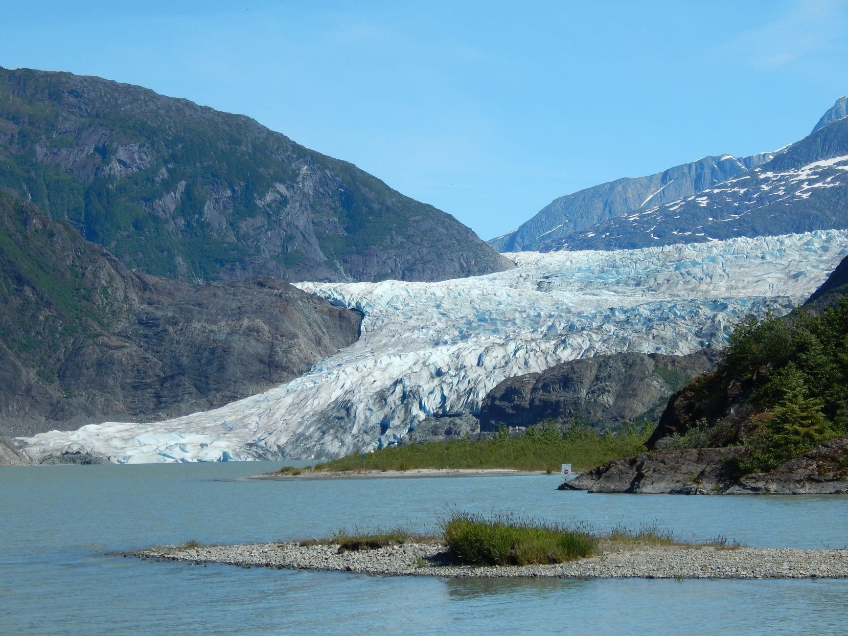
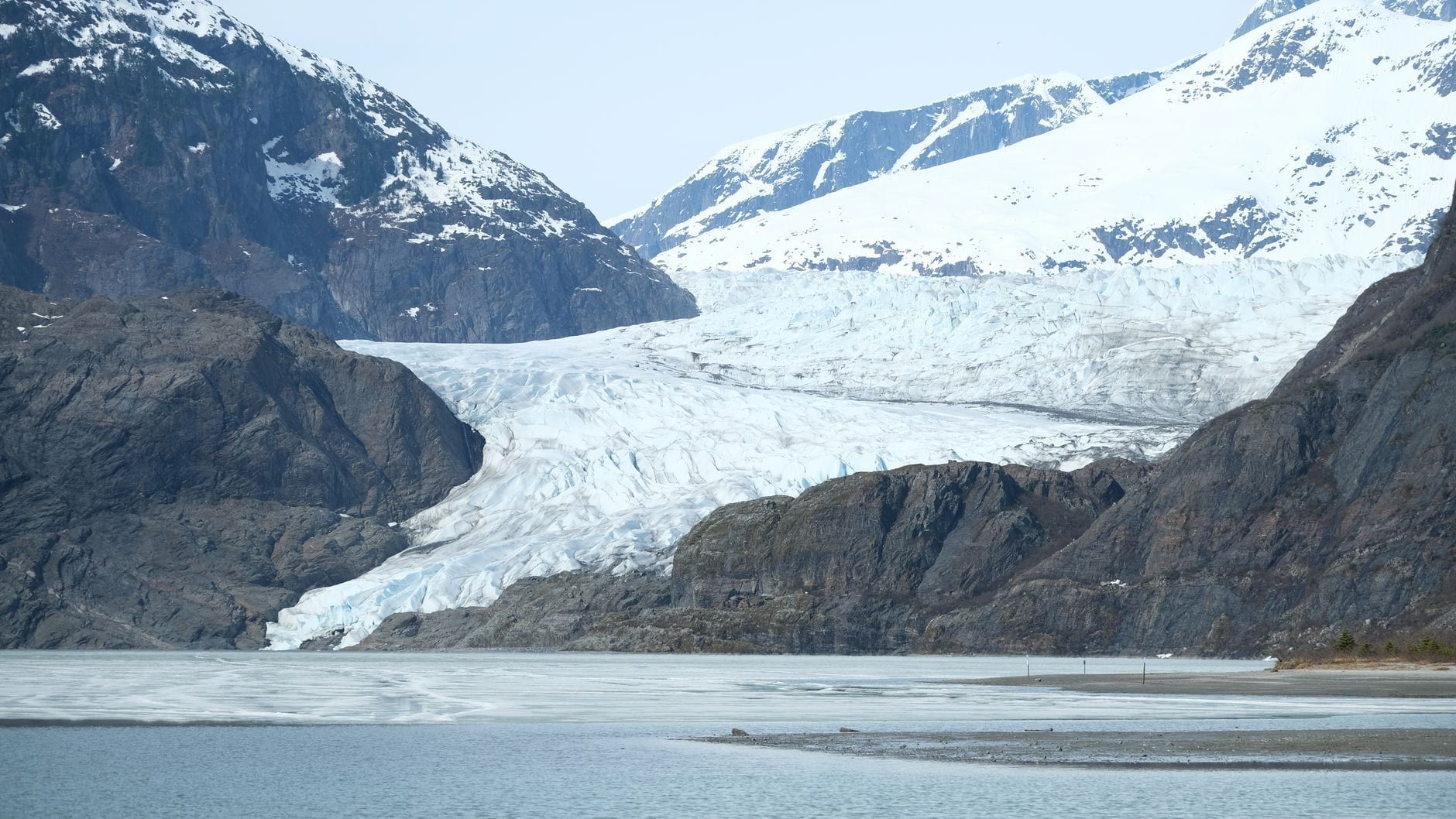
Mendenhall Glacier sits just 12 miles from downtown Juneau, and its recreation area packs eight named trails into 5,815 acres of rainforest, moraine, and lakeshore. Some are paved and flat enough for a stroller. One climbs 1,300 feet into backcountry where hikers have gotten lost badly enough to need rescue. Picking the right one comes down to how much time you have and how much climbing you actually want to do.
This guide breaks down every trail in the Mendenhall Glacier Recreation Area — distance, difficulty, fees, and what you'll actually see — plus safety details a lot of trail guides skip, like why the ice caves in everyone's Instagram photos aren't worth the risk. None of these trails puts you on the glacier itself; for that you'll want a guided trip, and you can compare options through Mendenhall Glacier tours.
Mendenhall Glacier Trails at a Glance
Mendenhall Glacier is the visible tongue of the 1,500-square-mile Juneau Icefield, dropping about 4,500 feet over 13 miles before it meets Mendenhall Lake. The surrounding recreation area, a unit of the Tongass National Forest, is the only glacier in Southeast Alaska reachable by road — 12 miles and roughly 25-30 minutes from downtown Juneau via Egan Drive and Glacier Spur Road. In November 2025 the glacier's face pulled back from the lake entirely for the first time in modern record, a shift tracked by researchers who've monitored the ice since 1942. None of the trails below cross onto that ice; they circle the lake, climb the hillside above it, or trace the creek beside it.
| Trail | Distance | Difficulty | Elevation gain | Pass needed | Best for |
|---|---|---|---|---|---|
| Photo Point Trail | 0.5-0.6 mi round trip | Easy | Minimal | Yes | Fast glacier photo, wheelchair users |
| Nugget Falls Trail | ~2 mi round trip | Easy | Minimal | No | Closest ground view of the ice |
| Trail of Time / Moraine Ecology | 1-1.5 mi | Easy | Minimal | No | Interpretive history, salmon stream, fewer crowds |
| Steep Creek Trail | 0.5 mi loop | Easy | Minimal | Yes | Salmon and bear viewing |
| East Glacier Loop Trail | 3.5 mi loop | Moderate | ~500 ft | No | Elevated glacier views, a real workout |
| West Glacier Trail | up to 8 mi round trip | Strenuous | ~1,300 ft | No | Closest foot approach to the glacier's edge |
Every trail except Photo Point, Steep Creek, and the Pavilion area is exempt from the day-use fee, including the parking lot itself. Powerline Trail and the Dredge Lakes network add a few more fee-free miles behind the visitor center for anyone staying more than a day — more on those below.
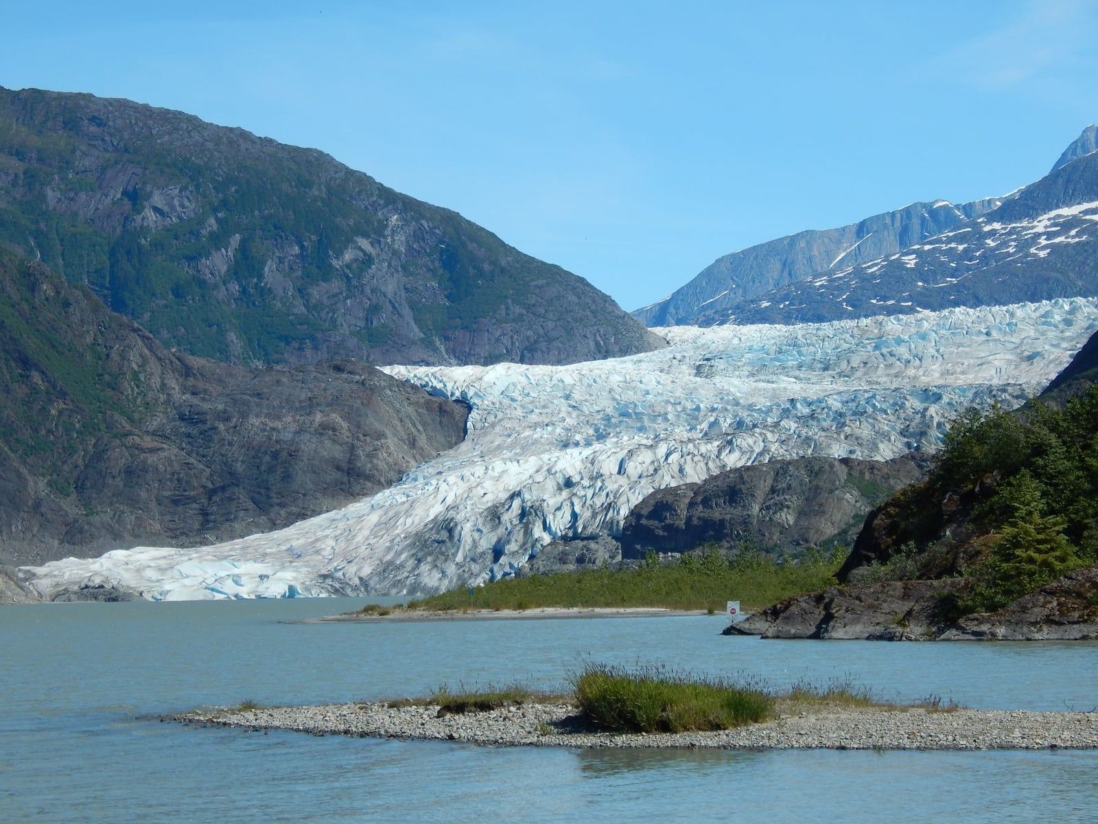
Easy & Family-Friendly Trails Near the Visitor Center
Five short trails fan out from the visitor center and cover most of what the roughly 700,000 people who visit each year actually do. All are walkable in under an hour and need nothing more specialized than decent shoes.
Photo Point Trail
Photo Point Trail is a paved, wheelchair-accessible path about 0.3 miles one way — call it 0.5 to 0.6 miles round trip — running from the parking area to a viewpoint with an unobstructed, head-on look at the glacier across the lake. It's the fastest way to get the shot you came for. Interpretive signs along the way explain the ice and the peaks behind it. Budget 20 minutes if you're not lingering, longer if the light's good.
Nugget Falls Trail
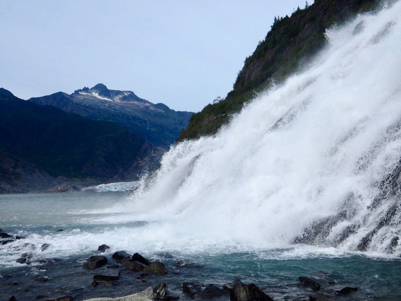
Nugget Falls Trail runs about 2 miles round trip on mostly flat gravel and boardwalk, ending at the base of a 377-foot waterfall that drops beside the glacier's edge. It's the closest ground-level view of the ice most visitors get without a boat or a guide. A few unpaved, uneven stretches make it tougher for wheelchairs and scooters than Photo Point, and the path can turn muddy after rain, which in Juneau is often. Plan on 45 minutes to an hour each way with photo stops, and wear shoes that can handle wet gravel.
Trail of Time
Trail of Time is a roughly 1-mile loop with interpretive panels marking where the glacier's edge sat in past decades — a blunt way to see how far it's pulled back. It's flat, easy, and usually quieter than Photo Point. No fee applies here.
Steep Creek Trail
Steep Creek Trail is a 0.5-mile boardwalk loop behind the visitor center, built for watching salmon and the black bears that come to eat them. Sockeye and coho spawn here from mid-July into October, and bears show up most reliably in August and early September. A day pass is required for this one, unlike most trails in the area — buy it at the vending machines in the parking lot before you walk over.
Moraine Ecology Trail
Moraine Ecology Trail extends about 1.5 miles from the Steep Creek boardwalk, crossing the same spawning stream farther from the crowds and looping through rocky moraine the glacier left behind as it retreated. It's fee-exempt, and a good add-on if you've already paid for Steep Creek and want another half hour of walking without doubling back to the car.
Moderate Hike: East Glacier Loop Trail
East Glacier Loop Trail climbs about 500 feet over 3.5 miles, the only trail in the recreation area rated moderate rather than easy or strenuous. Plan on 2.5 to 3.5 hours. The route alternates between rainforest and wooden boardwalks before reaching an elevated overlook with a wider view of the glacier and Nugget Falls than anything at lake level.
Stairs near the overlook get slick after rain. Start early — the trail draws crowds by mid-morning once the day's shuttles arrive, and you'll want the overlook to yourself for photos. Anyone after a real workout without backcountry commitment should pick this over Photo Point or Nugget Falls.
Strenuous & Backcountry Trails: West Glacier, Powerline, and Beyond
Past the easy loops near the visitor center, three routes serve fitter hikers wanting distance, elevation, or quiet: the full West Glacier Trail, the Powerline and Dredge Lakes network, and the guided options that get you onto the ice the trails themselves can't reach.
West Glacier Trail
The full West Glacier Trail runs about 8 miles round trip with roughly 1,300 feet of elevation gain, a 6-to-8-hour commitment well beyond anything else here. One account measures it differently — 3.4 miles one way to a junction where a route continues toward Mt. McGinnis for hikers with real backcountry experience. Either way, it's the trail that gets you physically closest to the glacier's edge on foot.
The trailhead sits near Skater's Cabin and the Mendenhall Campground, away from the visitor center and not served by transit — you'll need a car or a taxi. This stretch has a documented history of hikers getting lost or hurt badly enough to need rescue. Go with a partner, carry a map you don't need a phone signal to read, and turn back before the weather does.
Powerline Trail and the Dredge Lakes Network
Powerline Trail and the interconnected Dredge Lakes trails run behind the visitor center through beaver ponds and quieter rainforest, both fee-exempt and mostly skipped by first-time visitors. They're not glacier-view trails. Go for the birdwatching and the solitude if you've already done Photo Point and Nugget Falls and still have a half day in Juneau.
Getting Onto the Ice Itself
No trail in the recreation area sets foot on the glacier. West Glacier gets close, but the ice past the trail is riddled with hidden crevasses and unstable ground the Forest Service says is extremely dangerous without proper equipment and experience. Above & Beyond Alaska, Gastineau Guiding Company, and Harv & Marv's Outback Alaska are permitted to guide hikers onto the ice, while TEMSCO, NorthStar Trekking, and Coastal Helicopters fly in for landings on the icefield above. If walking on real glacier ice is the goal, book one of these rather than improvising — guided glacier hikes departing Juneau cover exactly this.
Which Trail Should You Choose?
Match the trail to your day, not the other way around.
- Cruise passengers with 1-2 hours: Photo Point Trail, then Nugget Falls if time allows.
- Families with strollers or wheelchairs: Photo Point Trail and the paved stretch near Moraine Ecology.
- Bear and salmon photographers: Steep Creek and Moraine Ecology, late July through September.
- Hikers wanting exercise without backcountry risk: East Glacier Loop Trail.
- Experienced backcountry hikers: the full West Glacier Trail.
Got a full day? Pair a morning hike with an afternoon on the water. Kayak tours paddle among icebergs on Mendenhall Lake for a look at the calving face no trail provides, and boats out of nearby Auke Bay run glacier and whale watching tours combining both in one trip.
Practical Logistics: Fees, Hours & Getting to the Trailheads
A day-use pass costs $5 per person, or $15 for a season pass covering the holder plus one guest; both apply only from May through September and only to visitors 16 and up. The pass is required for the Pavilion, Photo Point Trail, and Steep Creek — Nugget Falls, Trail of Time, Moraine Ecology, East Glacier Loop, Powerline, Dredge Lakes, and the West Glacier trails are all fee-exempt, along with the parking lot itself. America the Beautiful interagency passes are accepted and cover the holder plus three guests. Buy passes at the vending machines in the lot or inside the visitor center bookstore, and check current details at Mendenhall Glacier's hours and fees before you go.
The visitor center runs 9 a.m. to 6 p.m. daily from May 1 through September 30. In winter it drops to 10 a.m.-4 p.m., Fridays and Saturdays only, closed on federal holidays, with intermittent hours in April and October. The grounds and trails stay open year-round, 6 a.m. to midnight, whether or not the building is staffed.
The visitor center is 12 miles from downtown Juneau via Egan Drive and Glacier Spur Road, about 25-30 minutes by car, and 5 miles (roughly 15 minutes) from Juneau International Airport. Capital Transit's city bus doesn't stop at the visitor center — riders get off about 1.5 miles away and walk 30 minutes each way, which can push a one-way trip to an hour and a half. Cruise passengers usually do better with a private shuttle straight from the dock, typically $45-49 round trip, or a taxi at roughly $30-40 one way. See directions to Mendenhall Glacier for the full breakdown, or book a seat on a scheduled shuttle from Juneau if you'd rather skip the logistics.
Food and open beverages aren't allowed on the trails or around the visitor center outside two designated eating areas. Pack snacks you can eat at Photo Point or back at the car.
Safety, Weather & Wildlife on the Trails
Juneau's weather changes fast, and rain falls on more days than not, even in July. Layers and a waterproof shell matter more here than on most day hikes — boardwalks and stairs get slick, and the air at the East Glacier overlook runs noticeably cooler than the parking lot.
Steep Creek draws black bears fishing for spawning sockeye and coho, most reliably from August into September. Stay on the boardwalk, keep your distance, and never offer food. Mountain goats are visible year-round on the slopes of 4,225-foot Mt. Bullard behind the visitor center; a spotting scope near the building makes them easy to pick out even without your own binoculars.
Skip the ice caves. A well-known one collapsed in July 2014, days after a Forest Service ranger had already warned the public it was unsafe. The caves that do form change or vanish year to year, and reaching them usually means crossing lake or glacier ice officials have repeatedly flagged as unpredictable. No guide can promise a cave still exists by the time you show up.
The recreation area has also seen emergency closures from glacial lake outburst floods draining out of Suicide Basin, including a record flood in August 2025 — check current Forest Service alerts before a summer visit. West Glacier Trail carries its own reputation for stranding solo hikers who lose the route or misjudge the weather. Tell someone your plan, and turn around at the first sign either is going wrong.
- Waterproof jacket and sturdy, broken-in boots
- At least a liter of water per person
- Bear spray if heading past Steep Creek's boardwalk
- Trekking poles for the East Glacier or West Glacier climbs
- A headlamp if timing a hike near dusk
Frequently asked questions
Can you hike onto Mendenhall Glacier itself?
No maintained trail reaches the ice. West Glacier Trail gets you closest to the edge, but walking on the glacier means hidden crevasses and unstable footing that require a guided glacier trek or helicopter landing — operators like Above & Beyond Alaska, TEMSCO, and NorthStar Trekking handle that safely.
Do you need a pass to hike the Mendenhall Glacier trails?
Only for three spots: the Pavilion, Photo Point Trail, and Steep Creek, which need a $5 day pass or $15 season pass between May and September. Nugget Falls, Trail of Time, Moraine Ecology, East Glacier Loop, Powerline, Dredge Lakes, and West Glacier are all fee-exempt, and anyone 15 or under gets in free.
What is the easiest trail at Mendenhall Glacier?
Photo Point Trail. It's paved, wheelchair accessible, and about 0.3 miles one way from the visitor center to a straight-on view of the glacier's face.
How long is the hike to Nugget Falls?
About 2 miles round trip on mostly flat gravel and boardwalk, roughly an hour each way with photo stops. The falls drop 377 feet right beside the glacier.
Is the West Glacier Trail hard?
Yes. The full route runs up to 8 miles round trip with about 1,300 feet of elevation gain and takes 6-8 hours. The trailhead near Skater's Cabin isn't served by transit, and the area has a real history of hikers needing rescue.
When is the best time to see bears near Mendenhall Glacier?
Late July through mid-September, when sockeye and coho salmon are spawning at Steep Creek and black bears show up to fish, most reliably in August and early September.
Are the Mendenhall ice caves safe to visit?
No. A well-known cave collapsed in July 2014 shortly after a Forest Service ranger warned it was dangerous, and the caves that exist in any given year can vanish by the next. Reaching them typically means crossing unstable lake or glacier ice.
How do you get to the Mendenhall Glacier trailheads without a car?
Capital Transit's city bus stops about 1.5 miles from the visitor center, meaning a 30-minute walk each way. Most visitors without a car use a private shuttle from the cruise dock (roughly $45-49 round trip) or a taxi (about $30-40 one way).